beryl — the hurricane that keeps on giving

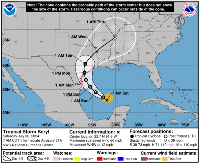
Beryl is still alive and causing grief, this time within the Gulf. And if the forecasts are to be believed, it will re-strengthen into another hurricane before striking the Texas coast. How close it will come to major hurricane status (category 3 and higher) is anyone’s guess.

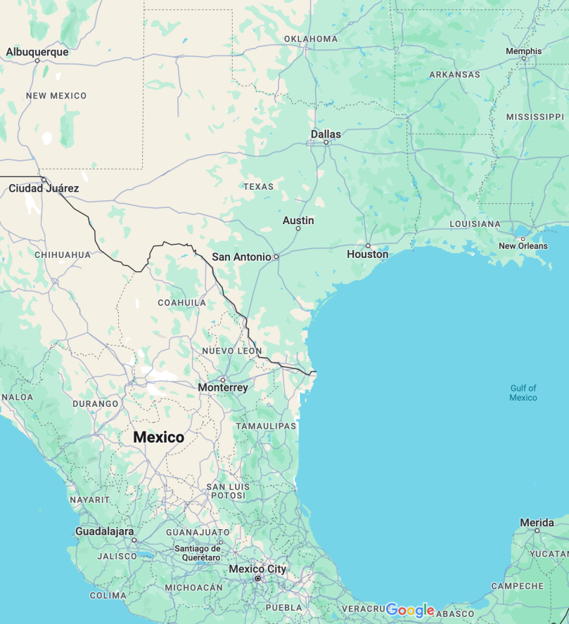
Because the NHC map never shows major urban centers, I snipped a section of Google maps in that area to show major urban areas under threat. The biggest is Houston, which always floods given any excuse of rain. The worst example of recent Houston flooding was with Hurricane Harvey in 2017. Harvey dropped anywhere from 30 to 60 inches of rain on the Houston metro area before it moved north-east into the US mid-west, causing flooding and tornadoes all the way before finally dissipating.

I should note that Beryl’s Gulf track has been steadily moving eastward every day. When the seven day track first reached into the Gulf, Beryl was forecast to make landfall on Mexico. I wouldn’t be surprised if Beryl’s forecast track shifts even further eastward. It is, after all, a guesstimate at best.

Links

hurricane beryl and the 2024 season

a night of bad thunderstorms and scared cats

A scared Luke riding out the storms

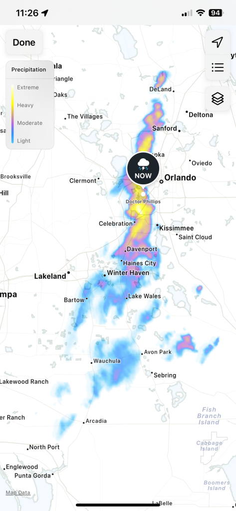
Last night, around mid-night, we had an hour’s worth of thunderstorms come rolling over the house. None of the iPhone’s weather apps forecast the rain. I only got a snapshot of the precipitation from the Apple Weather app after the rain started to fall. In the mean time all the little cats came into the bedroom to be with me, either up on the bed next to me, or else under the bed. Luke in particular came back and stood next to the bed and vocalized up to me, then leaped up to settle next to my feet. He hasn’t done anything like that in years, but last night sent him back to stay with his person. I suspect it’s going to occur more often as the climate, and the weather, grows more extreme.

I’m no weather person but I would call what the precipitation view of Apple Maps showed as a micro front. It formed north-to-south and rolled out towards the Atlantic coast at a rather rapid clip. This isn’t the first time I’ve experienced something like this, but it was one of the worst. Constant loud thunder and heavy downpours accompanied this meteorological event. It showed up without warning, and then left rather rapidly. When I went out this morning there was still standing water around my street where the nearly seven hours after that rain storm was insufficient time for full runoff to occur.

This is unusual for mid-Florida. It’s just a taste of what south Florida has been going through this year. Florida has an idiot governor who won’t do a damn thing to help mitigate the destructive effects.